
Foggy Fourth
Machiasport, Maine
From Wikipedia, the free encyclopedia
Machiasport is a town in Washington County, Maine, United States. The population was 1,160 at the 2000 census. Machiasport is a historic seaport and tourist destination.
In 1633, the Plymouth Company established a trading post here to conduct business with the Native Americans. But this was part of Acadia, territory which New France considered its own. So in 1634, the trading post was sacked by French forces from Port Royal under the command of Charles de Saint-Étienne de la Tour. In 1770, the area was granted by the Massachusetts General Court to 80 petitioners, 54 from Scarborough. It was first part of Machias, incorporated in 1784, then set off and incorporated as Machiasport in 1826.
History
In 1775, following the capture of the British ship HMS Margaretta by locals under leadership of Jeremiah O'Brien, the residents built a small breastworks here to guard the mouth of the Machias River and the area settlements. Later that year, the British sent four ships under the command of Sir George Collier that defeated the local militia, destroyed the breastworks, and burned several buildings. In 1777, the fort was rebuilt as a crescent shaped four-gun battery. In 1781 it was made part of the national defense and named Fort O'Brien. In 1808-1809, Lemuel Trescott of Eastport oversaw the construction of a blockhouse, barracks and battery. During the War of 1812, in September 1814 the British captured the fort and burnt the barracks.
In 1863, during the American Civil War, Fort Machias was built adjacent to the ruins of Fort O'Brien. It was a five-gun earthworks fort with Napoleon 12-pound cannon. It was actively manned from 1863 to 1865. In 1923, the U.S. government transferred the sites of both forts to the state of Maine. As of 2006, they are managed as a historic site by the Maine Bureau of Parks and Lands. In 1969, they were added to the National Register of Historic Places, as structure #69000024.
Geography
According to the United States Census Bureau, the town has a total area of 62.3 square miles(161.3 km²), of which, 21.3 square miles (55.3 km²) of it is land and 40.9 square miles (106.0 km²) of it (65.71%) is water. Drained by the Machias River, the town is located at the head of Machias Bay on the Gulf of Maine, part of the Atlantic Ocean.
The town is crossed by state routes 92 and 191. It borders the towns of East Machias to the north,Whiting to the northeast, Machias to the west, and (separated by water) is near Cutler to the east, andRoque Bluffs to the southwest.
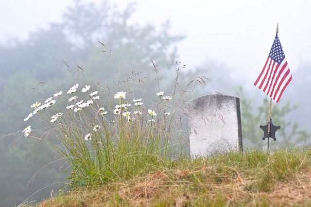
Today is our national holiday, July 4th and we're perched on a bluff overlooking the scene of the first naval battle of the Revolutionary War. I have relatives who swore allegiance to both sides. Some fled to the Island of Grand Manan, still safely under the Crown and some took part in the first naval battle. We'll have another low key day, no plans, maybe a parade, maybe not, weather is rather grim, but we don't care.
Thankfully no 2011 cat battles to report, the truce/alliance is still holding.
Quick snap of the cat peace
For the Record,
This day came in 'thick a fog' as the local say, 57 degrees f at 6:30 AM, 92% humidity(yuck) barometer falling with light rain.
Comments
Sign in or get an account to comment.


