
Google Earth
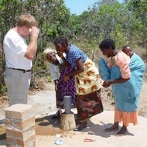
When we install a pump these days there are three readings to be taken.
The GPS
THe Depth and
A sample of the water for testing.
Of course we take a few pics as well
When we have internet access we get a chance to see the display.
This is a a pic of two pumps in the Doroba region showing two well locations plotted on the satellite image.
Modern technology is amazing, but plotting over 800 wells will be time consuming for someone.
The pic also shows the little houses within 500 metres of the pump, which is our aim.
Water for many
378
views
- 0
- 0
- Apple iPhone 4
- 1/14
- f/2.8
- 4mm
- 160
Comments
Sign in or get an account to comment.


