
Benchmark
Although I missed the brightest part of the day, I wandered down to Willy Wood and Spring Wood, which hug the boundary between Baildon and Hawksworth parishes, and therefore between Bradford and Leeds.
The woods were green underfoot with garlic, wood anenome and blubells. After the solid rain of the last couple of days, Gill Beck was in spate so any chance of crossing at the stepping stones and wandering up toward Hawksworth was scuppered.
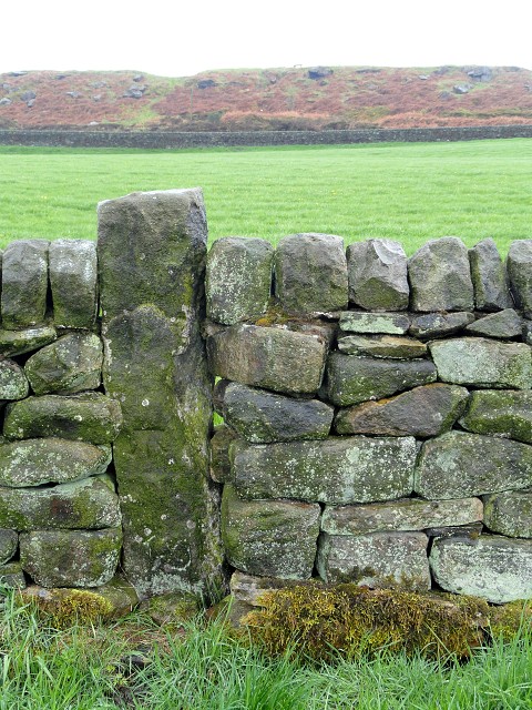
On the way back up to the moor I came across this old cut benchmark. The Ordnance Survey benchmark locator has this at SE15454063, 149.0503 metres above sea level at Newlyn. They last verified it in 1962, so Ordnance Survey, if you're reading this, it's still there.
The site of the moor fire that I showed you a month ago is visible at the top of the image.
Comments
Sign in or get an account to comment.


