
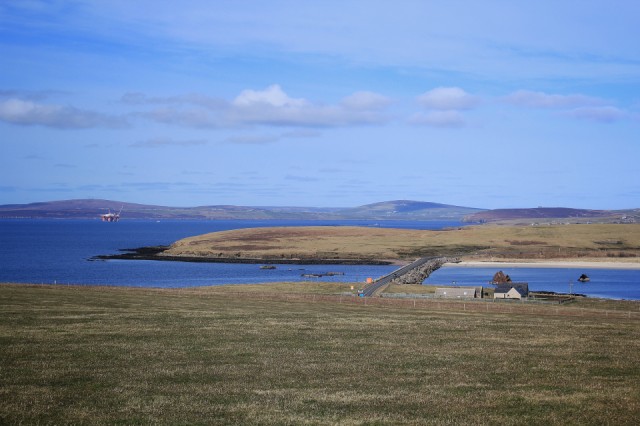
Churchill Barriers
A bit of a 'mooching about' sort of day. W has been nursing a cold for a few days and it came out with a vengeance last night. She didn't want to do anything too energetic so we decided today was a good day for a drive around. When we met Blipper MySisterCissie on Monday we said we were planning to drive down to the bottom of South Ronaldsay for a look and she warned us that there wasn't much there. She was right. Good views across the Pentland Firth towards the north coast of Scotland but that is about it. However, it's not far (nowhere is) and on the way we pass over the Churchill Barriers. My picture is of the second of four of the barriers going north, between the islands of Burray and Glims Holm, and close inspection will show an oil rig in the distance, and to the right of the barrier the wreck of one of the 'block ships' sunk in the channel during the First World War. These were intended to stop enemy ships from entering Scapa Flow but it was the attack on the Royal Oak during the Second World War that prompted the building of the barriers. A few more details for the interested here: http://www.scapaflowwrecks.com/wrecks/blockships/
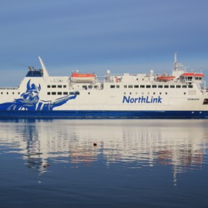
I've also added an extra taken from our cottage of the afternoon ferry leaving for Scrabster, just because I rather liked the reflections.
Comments
Sign in or get an account to comment.


