
My Zi-On's The Cliff
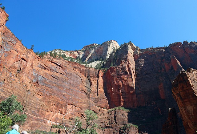
This shot is representative of the sharp cliffs of Zion National Park in Utah. Driving through the canyon was spectacular. The depth of field of the cliffs going down to the valley were amazing. The bus drove for miles and the scenery was just jaw-dropping.
Gotta see this LARGE!
How do you stand at the base of an ancient desert which has now become Navajo sandstone rock and capture the depth of the crevices? That's the top layer of the rocks, the tan part. You can easily see the layers of the sand and how the dunes must have been blown thousands of years ago - not quite so evident in this photo.
The rust color, the layer below, is called kayenta, and gets its color from iron oxide.
Water gets absorbed by the sandstone, which is porous, then seeps though and down to the kayenta, but that takes hundreds of years. It hits the kayenta and then spans out horizontally.
The Virgin River winds through the canyon and is a tributary of the Colorado River. It's about 154 miles long and drops at 70 feet every mile, and meets The Colorado at Lake Mead. The river continues to carve the canyon, at a pace of about one inch per century.
I learned a lot about it today, took notes and will be writing everything out in a more formal journal when I have the chance. I won't even go into the ecosystems and the former inhabitants.
A great contrast from yesterday and another tough choice among the pics to choose from. I hope you like this one.
Bryce Canyon National Park and Capitol Reef National Park tomorrow.
Comments
Sign in or get an account to comment.


