Burdiehouse Limekilns
Starting at Old Burdiehouse we followed the burn downstream until the path was closed by a new development, so we turned round and, at the main road, wandered up through a new estate to see the old limekilns.
I had always intended to photograph these, but we were never on foot in that area and then, to my dismay, a housing estate was built close by.
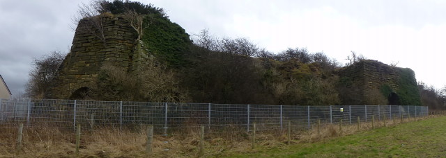
As you can see in this panorama the kilns are surrounded by fencing which obscures the view. Category B listed in 1970, they are described as:- a Group of 3 kilns, all brick-lined. North kiln is polygonal buttressed block. Middle kiln is in a segmental block with one buttress. South kiln is in oblong block.
From the 1893 maps they appear in extensive lime works: Canmore state that Burdiehouse was one of the largest of the Lothians, serving both the agricultural and building markets for lime. The kiln was loaded with limestone, from a quarry to the rear, and coal from a local coal mine. Materials were assembled and fed into the top of the kiln.
The mine became flooded and was sealed in the 1970's, now covered in ivy the kilns appear to be perfect situation for birds to roost and nest.
Comments
Sign in or get an account to comment.


