
The New...All Bad
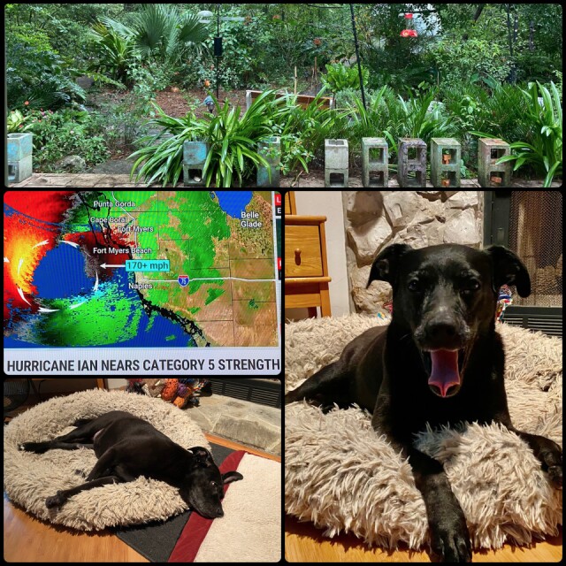
Hurricane Ian is just about to make landfall at Ft. Meyers on Florida's west coast. Ian's wind strength is now at 155-170mph. That's a strong Category 4 storm almost a Cat 5. The storm's speed is around 10mph, very dangerous because that allows it to drop an unbelievable amount of rain! Flooding will be a huge problem from not only the high waves but also when the many inland rivers and other waterways overflow from heavy rainfall. Storm surge predictions along Florida's west coast are simply terrifying! 12 to 18 feet for Ft. Meyers. There have been tornado warnings issued for the last two days all over south Florida. Tornados are also a major threat during these dangerous storms. Mandatory evacuations of Florida residents and visitors in these coastal and low-lying inland areas have been going on for days. Those who have chosen to remain are now unable to leave. As conditions worsen, emergency personnel will not be able to venture out.
C and I live in Gainesville in North Central Florida, which is predicted to experience Tropical Storm intensity winds in gusts, maybe 30mph or so, and 18-24 inches of rainfall. Compared to everyone south of us, we are in a good place. I've been through many Hurricanes in my life but this one makes my blood run cold.
In the collage...view of the back yard, the bird feeders will remain up until the very last minute. All potted plants are hiding out in the greenhouse. Tara waiting for Hurricane Ian. That's a big yawn! Be safe my friends. m
Comments
Sign in or get an account to comment.


