
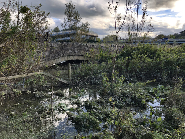
There's water under the bridge
SATURDAY
Here in North Wales we seem to have missed the worst of Storm Babet, but even so we had almost continuous rainfall for the last 24 hours which has caused extensive flooding.
Pont Dafydd is a scheduled ancient monument located close to the A55 North Wales Expressway (which can be seen in the background). It's about five kilometres from home.
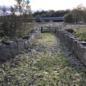
The bridge is stone-built, single arched with rough parapets dating to AD1630. It is still in virtually untouched condition with original cobble paving and axe-dressed masonry.
Over the years, the course of the River Clwyd has changed and in 1969 the river was rerouted completely when the A55 was widened. Consequently, the medieval bridge was no longer needed.
It’s a place which has seen so many people pass over it over the years - in the 17th Century the bridge was used by pilgrims making the ten mile trek from St Asaph Cathedral to the holy well at Holywell, however these days it hardly sees anyone and today sits alone in a field used only as a footpath and for farm traffic.
Normally, the bridge now spans dry meadow land, but the rainfall of the past 24 hours has caused the field to flood giving the bridge some purpose again.
More detail of the bridge can be seen in the extra.
Comments
Sign in or get an account to comment.


