
Mono Monday: Home
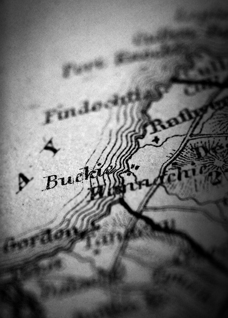
I collect old maps of Scotland, but when I came up with the idea for this shot, I realised that most of them wouldn't work as Buckie is rarely featured on older maps.
This is something that fascinates me, an aspect of history that we can follow through cartography: how places vary in relative importance as time passes. Today, Rathven is a tiny hamlet, but it's a settlement that dates back many hundreds of years and is the centre of the parish to which it gives its name. Buckie, now a town of about 8,000 people, only grew to any size due to the fishing booms of the late 19th and early 20th centuries. In early maps, Rathven is shown as by far the most significant place in the area; Buckie, if it appears at all, is tiny, less notable than what are now much smaller villages strung along the coast to the East.
This is from a county map of Banffshire dating from about 1854. The transition - the decline of Rathven, the rise of Buckie - is clearly well underway.
This is from a county map of Banffshire from the late 1800s.
Today's challenge is hosted by Skeena.
Comments
Sign in or get an account to comment.


