
Stormlines
issued by the Weather Bureau today
Australian Government Bureau of Meteorology
Victoria
Notes on the Weather
Issued at 4:49 pm EST on Wednesday 11 August 2010.
Recent Events
A deep low pressure system moved across northwest Victoria yesterday to be over Central Bass Strait for much of today, gradually moving eastwards. Widespread rain was experienced statewide yesterday and overnight as cloudbands moved around the low, initially spreading from the north then wrapping around the western flank into the Western district where the highest falls were recorded. Most totals in the Western District ranged from 20 to 50mm in the 24 hours to 9am and the highest was over the Otway Ranges where 92mm was recorded at Weeaproinah, 82mm at Mount Sabine and 60mm at Apollo Bay. Some flash flooding was reported around Port Fairy and Warrnambool this morning with Port Fairy also recording 56mm of rain in the 24 hours to 9am. Elsewhere in Victoria most totals ranged from 5 to 25mm although the Ovens, King and Broken river catchments also had higher totals of 20 to 40mm as the initial band moved south yesterday.
Thunderstorms were also a feature across the Northern Country and Northeast districts yesterday afternoon and evening as the low deepened with reports of some associated hail as well as an F-zero tornado briefly touching down in Echuca-Moama. The Fujita (F) scale rates tornadoes based on damage and an F-zero indicates associated winds in the range of 64-116 km/h. Note, that despite public and some media perception, there is no such entity as a "mini-tornado" and in fact the vast majority of actual reported tornadoes worldwide are F0-F2, rather than rare, large and devastating F5's often associated with the U.S. Another feature of the low pressure system has been the strength of the winds and in particular a band of vicious, gale force winds wrapping around the western flank of the low with rain making conditions hazardous - especially at elevated coastal locations. Strongest wind gusts recorded at BOM sites were 139 km/h at Mount William and 100 km/h at Cape Otway. Damage associated with these winds has been reported in the west of the State.
Rain continued to fall over most locations today, although was very isolated over most of Gippsland and the western Mallee/Wimmera. Heaviest falls continued to ccur along the western flank of the low over areas of Western and Central districts with generally a further 10 to 30 mm being recorded in the 6 hours to 3 pm. Widespread totals of mostly 1 to 5 mm were also recorded across the rest of the Central district and across the northeast. The highest recorded rainfall totals in the 6 hours to 3 pm include 54 mm at Mount Sabine and 39 mm at Mount Cowley in the Otway ranges.
Overnight minima were generally within 2 degrees of average, with the lowest being minus 3 degrees at Mount Buller and Mount Hotham. Maximumn temperatures to 3 pm were all 1 to 5 degrees below average except for the far southwest which was slightly above average. The highest temperature recorded today was 17 degrees at point Hicks and Gabo Island. In Melbourne the temperature ranged from 7.3 degrees at 5:00 am to 11.4 degrees at 12:24 pm. There was 7 mm recorded in the City gauge in the 24 hours to 9 am with a further 3.6 mm recorded to 4 pm.
Explanatory Notes
A low pressure system over Bass Strait will move southeastwards overnight and during Thursday before moving over the Tasman Sea on Friday. A high pressure ridge will cross Victoria from the west on Friday with the main high centre tracking well to the north. The next cold front will be relatively strong and is expected to enter western areas of the Statet by saturday afternoon, and will cross the remainder of the State early Sunday.
Warnings for Victoria
Warnings current:
Coastal Waters Wind Warning for Victorian waters between SA-VIC Border and 60nm east of Gabo Island.
Local Waters Wind Warning for Gippsland Lakes, Western Port and Port Phillip.
Ocean Wind Warning.
Ocean Wind Warning 2.
Severe Weather Warning for Alpine Areas, Western, North Central, Northern Country, Wimmera, Central and West and South Gippsland forecast districts.
Severe Weather Warning for Western forecast district.
Warning to Sheep Graziers for Alpine Areas, North Central, Central, West and South Gippsland and East Gippsland forecast districts.
Flood Watch for Greater Melbourne.
Flood Watch for Barwon, Hovells Creek and Otway Ranges.
Flood Watch for North East Victoria.
Flood Watch for the Goulburn and Broken Basins.
Victoria Flood Warning Summary.
Flood Warning - Barwon River.
Flood Warning - Hopkins River.
Flood warning for Seven Creeks/Castle Creek.
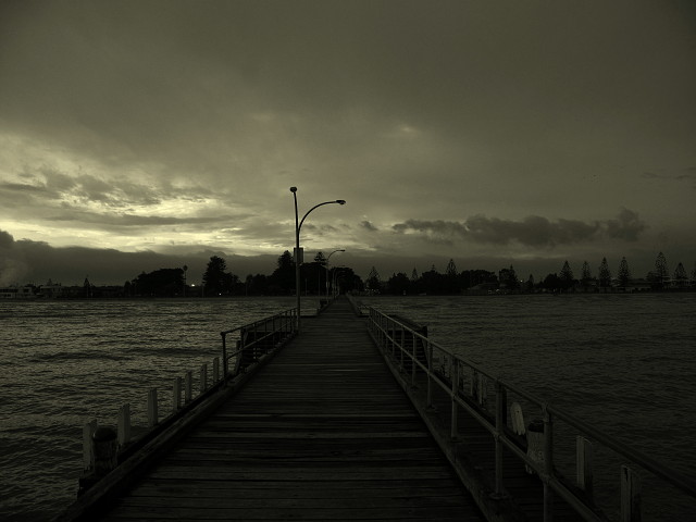
Photo taken at 4:50 pm at Altona Pier
298
views
- 5
- 0
- Canon PowerShot G10
- 1/50
- f/3.2
- 6mm
- 80
Comments
Sign in or get an account to comment.


