
Pictured Rocks National Lakeshore
Wednesday 29th July
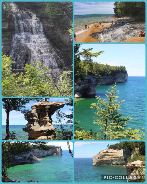
Today we went hiking in the Chapel Falls of Pictured Rocks National Lakeshore. Pictured Rocks derives its name from the 15 miles of colorful sandstone cliffs northeast of Munising. The cliffs reach up to 200 feet above lake level, and have been naturally sculptured into a variety of shallow caves, arches, and formations resembling castle turrets and human profiles. Streaks on the face of the cliffs come from groundwater leaching out of the rock and evaporating, leaving streaks of iron (red), manganese (black-white), limonite (yellow-brown), copper (pink-green), and other minerals. The weather continued pleasantly hot and sunny, and we had a great hike - a little over 10 miles! We hadn’t intended it to be that long, but with the Visitor Centers closed we couldn’t stop in and get maps of the particular areas, and the map we had we decided wasn’t totally to scale! We started at Chapel Falls, (top left), where we were pleasantly surprised to see how much water there was still, even late in the summer. We passed Chapel Rock, below and, further into our walk, saw Lovers Leap Arch in the distance, bottom left. a great day!
Comments
Sign in or get an account to comment.


