
Joe Brown's Numbers
One for the orienteers out there.
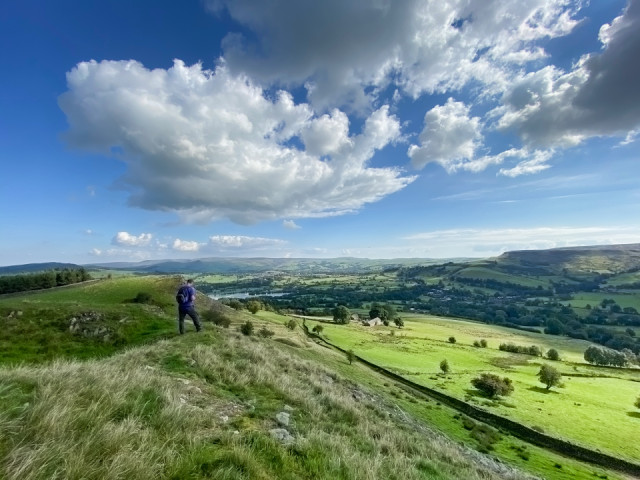
Paul and I went on another geocaching expedition today and it proved to be a long day as we walked 13 miles in the High Peaks of Derbyshire.
We managed 41 geocaches and found all of them, which surprised us, but our main aim was a multi-cache called Joe Brown's Navigation Challenge. A multicache is a geocache that involves visiting various locations to gather information and this one is a bit special because it involves 20 locations covering about 20 miles. We have split the walk into two and completed 10 of them today and intend finishing it next week.
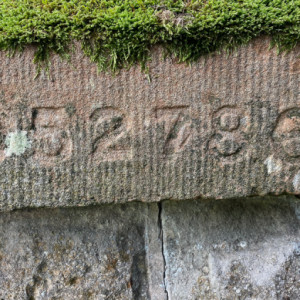
Joe Brown was a famous mountaineer in the 1950s and 1960s who died earlier this year. In the early 1960s he worked at Whitehall Outdoor Centre and created an orienteering course in the surrounding area by carving numbers, approximately two inches high, into the rock with a hammer and chisel. The numbers are either grid references or a bearing and distance which lead you from point to point. They aren't easy to spot and being grid references aren't really precise enough but additional information is available and Paul did a lot of preparation so we had GPS co-ordinates to move from point to point. We managed to find all the carvings and I have put an example in the extra.
The main photo is Paul signing the logbook for a cache called The Dragon's Nest. There were fantastic views on the whole walk.
Comments
Sign in or get an account to comment.


