Where sheep may safely graze...
IT would have been an idyllic day to do saltmarsh survey if it hadn't been for the strong, gusty wind that made turning over sheets of paper well nigh impossible! A lot more walking today, as both of our survey areas were quite large.
We started at Gedney Drove End, a rather weird area with industrial scale farming behind the sea bank, virtually devoid of life as all the crops had been harvested, leaving acre after acre of perfectly flat tilled silt, a warm ochre in colour. And over the sea bank, one of the UK's largest areas of wilderness, albeit with areas of military infrastructure on the Holbeach bombing range.
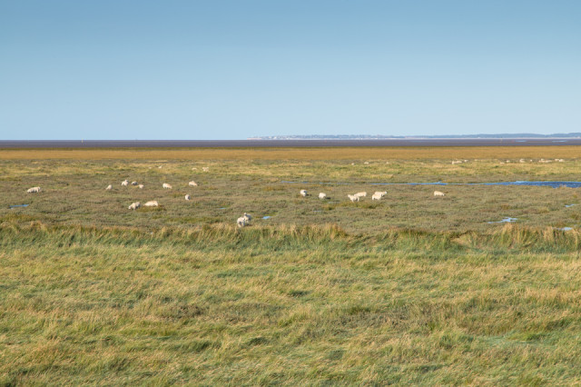
From there we headed across Sutton bridge (very cute), along the A17 and into Norfolk, with our next block of saltmarsh being located close to the almost invisible Ongar Hill. We had a bit of trek before we even reached the survey area, and I then sent Chris to yomp ahead to survey the northern end, while I progressed more slowly in the southern end. Most of the grazing on the Wash is carried out by cattle, so we were quite surprised to see a couple of large groups of fat lambs happily grazing among the Sea-purslane and saline pools. If you look carefully you can just see the town of Hunstanton on the horizon, which marks the extreme eastern edge of the Wash.
Comments
Sign in or get an account to comment.


