
Testfield
Maps were, for a very long time, a matter of measuring distances from the ground or from the sea. During the fifties, aerial photography had become more accurate and enthusiasts wanted to do map-measurements from the air. People from KTH, the Royal Technical Higschool claimed that that kind of measurement was far too inaccurate to be used in cartography. To test it, 184 blocks of concrete was laid out over the flat "Alvar" (huge limestone plain) in the south of Öland. The blocks were used for calibration of the instruments in use and it proved that aerial photography was far more accurate than measuring on the ground. These tests led to a complete change in the art of cartography in Sweden.
The whole experiment were kept very secret because of the cold war and for a long time nobody knew anything about the blocks of concrete on the plain until a journalist, not long ago, started to enquire about them and a book was written about the background and the test-programme.
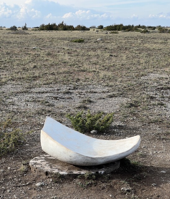
The test-field has been used as an exhibition ground during the summer of 2022. 25 of these blocks has been used as a place to put a work of art and they have been one of the attractions during the summer for cyklists or wanderers who wants to experience Alvaret, the nature and art.
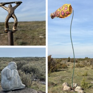
I visited four of them today on my walk of about five km. The main is called "Space fragment" by Pia Hedström. The compilation of the other three are top left: "The solution" by Carl Wellander, bottom left: "Little girl" by Anna-Karin Liedberg and right: "Staying alive" by Kerstin Dal-Norén. The area can be seen here but is unfortunately only in Swedish as far as I know. Every star is clickable to find out more about the art.
Comments
Sign in or get an account to comment.


