Flood defence
There was going to be some order to my One River project. I had intended going close to the source of the River Eden and finding the first bridge and then gradually moving downstream. However, the weather at the moment is most definitely not the weather for climbing into the hills, so that may have to wait a while.
Meanwhile, we were in Carlisle and decided to look at the rivers in the centre of the city, after all this rain. This of course brought me back to the search I was embarked on this time last year, to find the 40 plaques that had been built into the flood defences around the city centre after the serious flooding in 2005. (Full details of the flood and the plaques and the beginning of my search is here.)
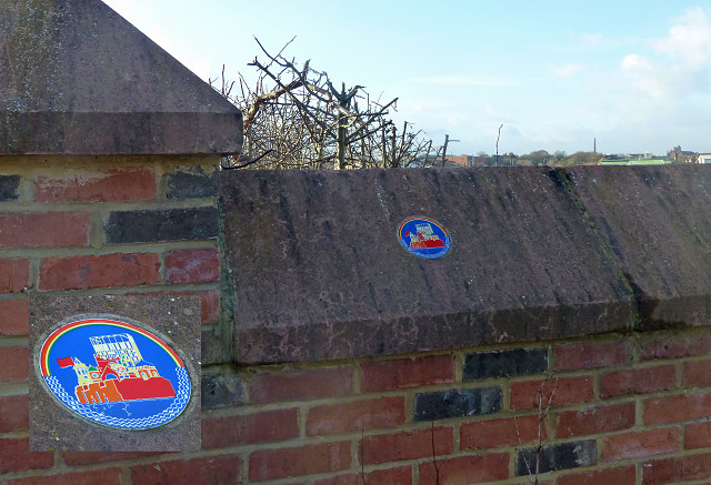
The Eden was indeed in flood, but not dangerously so. The problem with Carlisle is that three rivers join up right in the centre and it was this confluence that caused the 2005 floods. The plaque pictured here is close to the River Petteril and that was indeed today much higher than it should have been. This photo shows the point at which the Pettrill meets the Eden, usually a stream flowing into a river! This shows why the golf course on the banks of the Petteril was closed!
This particular plaque, designed by artist Liam Curtin, shows the skyline of Carlisle protected by the city walls, (I have added a larger image so you can see the detail), and became the emblem for the completed flood defence scheme. It was hoped that the new walls would protect the city against water, as the old walls had protected against enemies. I rather like it.
Sobering to think that there are many people at this moment around the country suffering from floods, just as the people of Carlisle did in 2005.
For the record - I managed to find 39 out of the 40 plaques and they are all recorded. I have still to find the last one, but that is another story. The last one I blipped is here, together with a list of the links to all the others that I blipped.
Comments
Sign in or get an account to comment.


