Ramble #1 ~ Flotterstone - Dreghorn Ranges
Thursday has turned into a bit of a wandering day, and so a new thread begins. Rambles.
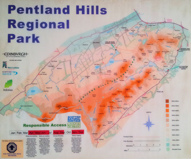
Encouraging me to do a little more exercise to help the diet, a couple of friends from work and I headed out to the Pentlands again last night. The weather wasn't great. In fact, it was downright manky, so the camera stayed in the car. This is the map at the Flotterstone Ranger Centre, taken from the phone as a bit of a BEB.
Last night's route took us from Flotterstone up to the Army's rifle range at Castlelaw hill and up to the Fort before ascending further and walking between the peaks of Capelaw and Allermuir Hills before descending back to Dreghorn Ranges and the waiting cars (the top right bit of the map).
Stats
Length: 4.46 mile
Time: 1 hr 51 mins
Total Ascent: 741 ft
Max Elevation: 1,404 ft
Conditions: Scorchio / Sunny / Pleasant / Cloudy / Dreich / Sodden / Typical Scottish
Sorry I didn't post last night. I was knackered by the time I got home and, erm, fell asleep in front of the telly. Woke up with a cricked neck and a shirt to iron. 15 mins later I'm sure I was snoring in my bed!
Comments New comments are not currently accepted on this journal.