
Map of the Way
Please see LARGE
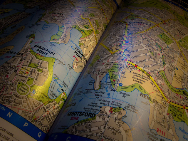
Here I am, planning the route for Thursday's stage of the trek. Near as I can figure there are four stages to go before I reach the steps of the GPO. What may add one extra stage is the distance we will need to cover while walking around some of the complex bays, inlets and hidden away backwaters on the south bank of Parramatta River as we approach the city centre.
This street directory map, in combination with a close examination of Google Earth, is our central planning strategy. You can see some of the amazing complexity of Sydney Harbour and the fascinating points of land that are to come. If you look carefully to the left of shot you may see a line across the blue stretch of water. This is the route of the historic old "Mortlake Ferry" (sometimes referred to as the "Old Putney Punt" which allows 15 vehicles to cross this narrow part of the waterway every half hour (make sure you come this way if you are in a special hurry). We intend to take that ferry across to the southern side IF we get the timing right.
What I like best about the Parramatta River/Port Jackson area are the place names - Hen and Chicken Bay, Kissing Point, Looking Glass Bay and Breakfast Point are just a few of the places that we will pass through.
Just one small bit of boasting. Because I was in a hurry and always lazy, I just plain hand held the camera for this 1/6th second exposure. Try THAT with a DSLR.!
Comments
Sign in or get an account to comment.


