
Groningen City Boundary Markers - Book C
Another rainy day so I got into the car again for the fifth blip in the Groningen City Boundary Markers series. Previous entries:
Book U
Book O
Book N
Book G
This map shows the location of all the boundary markers (see below for explanation of the letters assigned to the markers). Today's blip is actually the first book of the markers (it corresponds with the letter C in the word CRUONINGA). The sign next to the marker says:
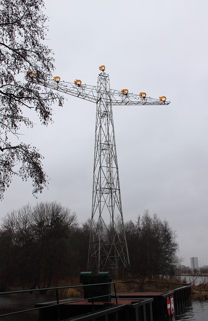
For centuries, town borders were marked by walls and fortifications interspersed with highly decorated gates. The gates gave the outside world access to the towns and opened them up to the surrounding countryside. Many of the old walls and gates were pulled down in the 19th century, when towns lost their traditional shape. Groningen received the town charter in 1040. As part of the celebrations to mark is 950th anniversary, it was decided to erect a series of markers indicating the boundaries of the city and spelling its ancient name CRUONINGA. The project has been designed by Daniel Libeskind.
Kurt W. Forster's design is based on two elements which determine the landscape, water and earth, and two forms of energy, gas and electricity. The natural gas in Groningen was created millions of years ago by a process of chemical change in the layers of the earth's crust. History itself can be regarded as a similar kind of metamorphosis. Forster uses an electric mast as the basis of his design, crowned with seven burning gas flames. Every morning and evening, digital figures on the mast light up for one minute at twenty to eleven (10:40), the time which corresponds to the year in which Groningen received its town charter.
Comments
Sign in or get an account to comment.


