
Groningen City Boundary Markers - Book R
Note to self: check camera settings before shooting away! I just discovered I've been shooting at a fixed ISO rating of 400 for the last couple of days. WHY??
This is the sixth blip in the Groningen City Boundary Markers series. Previous entries:
Book C
Book U
Book O
Book N
Book G
This map shows the location of all the boundary markers (see below for explanation of the letters assigned to the markers). The sign next to the marker says:
For centuries, town borders were marked by walls and fortifications interspersed with highly decorated gates. The gates gave the outside world access to the towns and opened them up to the surrounding countryside. Many of the old walls and gates were pulled down in the 19th century, when towns lost their traditional shape. Groningen received the town charter in 1040. As part of the celebrations to mark is 950th anniversary, it was decided to erect a series of markers indicating the boundaries of the city and spelling its ancient name CRUONINGA. The project has been designed by Daniel Libeskind.
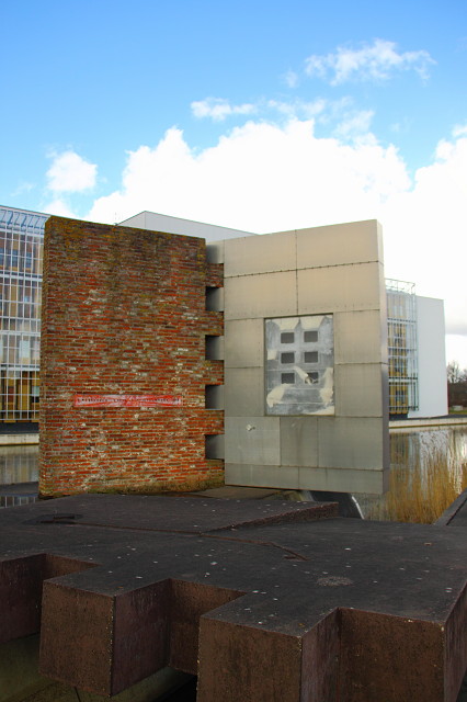
Akira Asada is an economist who has designed a book with Shiro Takata consisting of two vertical pages made from several different materials. A third broken page lies like a bridge over the water, providing access to the work. Video monitors built into the vertical pages can be used for messages, news from all over the world and short emblematic texts. Signals from space received by the Astronomy Department of Groningen University can also be shown on the screens.
It seems that the video monitors have been removed from this work; I could not find any. If there were any, they were certainly not switched on at the time of my visit.
The building behind the marker is the new buidling of Martini Hospital Groningen, which was completed in 2007 after four years of work. It is a beautiful building in its own right.
Comments
Sign in or get an account to comment.


