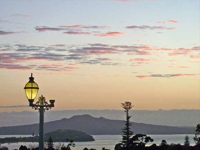
Rangitoto
Sunday morning, and I decided against an hour long run, being content with 45 mins. Went to the Auckland Domain and up to in front of the Museum where I could see Rangitoto Island.
Rangitoto sits in the Hauraki Gulf just east of North Head the older and lower volcanic cone between the city and Rangitoto. The Hauraki Gulf enters the Waitemata Harbour between North Head and Bastion Point, which is a little south of where I was standing to take this picture.
Rangitoto is a volcano and it emerged from under the sea in a series of eruptions about 700 - 800 years ago. That makes it the most recent volcano in the Auckland region, and the youngest island in the Gulf. The island is almost perfectly round, and it looks very much the same from whichever angle it is viewed. It is 250 m high, and is about 2300 hectares in area. The landscape is typically volcanic, with lava trails in all directions. A wide diversity of plant life is becoming established on the island; mosses, ferns, trees. It has a large pohutukawa forest, larger than anywhere else.
The Crown purchased the island in 1854, and it was set aside as a recreational reserve in 1890. Nevertheless, scoria was mined and shifted to the mainland for many years. In the 1920s and 1930s private holiday dwellings were built on Rangitoto; such dwellings are known in New Zealand as a bach (pronounced batch), and were generally built by the families who used them. No new baches have been allowed since 1937 and they are now regarded as irreplaceable parts of New Zealand's history, and are thus protected. Previously, the Council wished to demolish each one as its owners died.
Visitors to Rangitoto can walk on formed track to the top for magnificent views in all directions, or can purchase a ride up on a small "train". Most people walk down. Ferries call by relatively regularly. We stayed in Auckland for almost 30 years before we visited for the first time; it was "always there".
Comments
Sign in or get an account to comment.


