
Hauraki Gulf
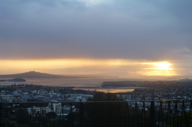
Delayed my morning run for 15 minutes to let the rain stop, which it fortunately did until after I got back from a run to the top of Maungawhau, where I took this picture of the Waitemata Harbour out to the Hauraki Gulf. As can be seen from the clouds in the picture, there is a lot of rain about at present.
I like this shot more than two or three other very blippable morning pictures. Mainly because of the softness of the colours. The wee cone in between the mainland and Rangitioto Island (Auckland's most recently active volcano) is North Head. A horizontal line from North Head runs into Takaparawhau Point, obscuring Bastion Point, and that is the line of separation between Waitemata Harbour (to the left) and the Hauraki Gulf.
Behind Rangitioto is Motutapu Island and in the far background one can see the hills of the Coromandel Peninsula, which forms the other shore of the Gulf. Immediately below the glowing sun is Waiheke Island.
The sun struck piece of water closest to the camera has been "separated" from the Harbour by a causeway carrying an important road from the Eastern suburbs into the central city. It is crossed by a railway line, also on a causeway; that is the dark line. The tide was well out at the time I took this picture.
In May I posted a photo of Rangitoto from in front of the Museum. This shot gives rather more of the Gulf.
Comments
Sign in or get an account to comment.


