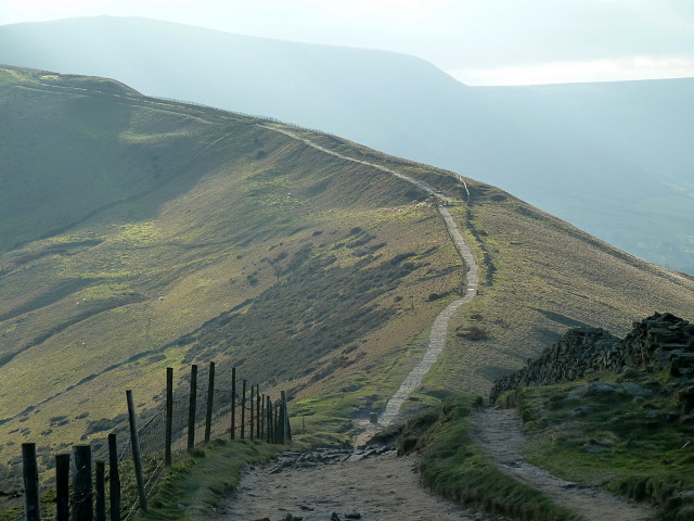
Ridge path to Hollins Cross and Mam Tor
Today I had a full day walking in the Peak District - somehow I have never visited Edale, which really needed rectifying. I parked below Mam Tor and dawdled along a very misty Rushup Edge. Then descended, crossing the head of the Edale valley to Upper Booth and a short stretch of the Pennine Way to Gindsbrook Booth where the famous path starts (or finishes). I was very taken with the village and the other smaller "booths" along the valley side.
I skirted round the north sides of the valley, eventually ending up at the foot of Lose Hill. For some time I had become conscious of the passing time, so the second half of the walk was rather rushed (payment for failing to rush up Rushup Edge, I suppose). So I sadly decided to skirt the top of Lose Hill, one of the main objectives of the walk. By now the sky was finally clearing with brief sunny spells, and the remainder of the walk was most enjoyable. The ridge is a delight, and features on the picture selected for the blip, with the final climb of the day to Mam Tor.
Used the Ordnance Survey service to plot the route, came out at a fraction over 13 miles......
Comments
Sign in or get an account to comment.


