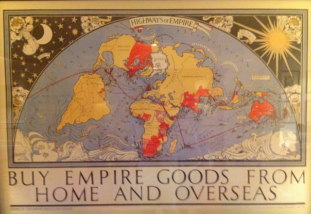
British Empire Trade Map from 1927
This map with an interesting and unique projection placing the UK near the centre of a half circle, enables the imperial trade flowing around the Cape and to Australia and New Zealand to be prominently displayed.
The map was drawn by MacDonald Gill in 1927 for the Empire Marketing Board, with the aim of encouraging trade within and between the British Empire's Dominions, Colonies, Protectorates and Mandates.
It is to be found preserved in a place of honour at a hotel in Katoomba in New South Wales.
Noteworthy is the way that the Anglo-Egyptian Sudan is shown hatched, as are the League of Nations Mandates on Tanganyika and South West Africa. Also some control over Transjordan and Iraq is indicated.
However it is the imperial trade that matter most and is indicated by the many cargo ships steaming between the ports of the British Empire.
570
views
- 0
- 0
- Apple iPhone 4S
Comments
Sign in or get an account to comment.


