Lunch time escape
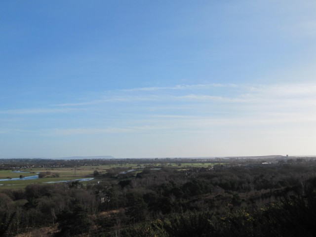
I shocked the office by taking lunch today. Donned my wellies and power walked up St Catherine's Hill, Christchurch ..a walk I have only ever done as part of a circular so in one direction. This time I turned around to walk back and spotted a view from a trig point which I had never seen. It was the highest spot on this hill overlooking the Avon Valley and I was amazed to realise I could see everything I love about Christchurch spread before me: the Priory church in distance to the right, Hengistbury Head behind it with Chrischurch harbour in front. Mudeford spit and beach huts extending to the left from Hengistbury head and in the distance to the left the Isle of Wight Tennyson Down and the needles. In the foreground is the Avon Valley with the Avon meandering gently before it splits nearer to the harbour.
St Catherine's Hill is a 35 hectare area of heathland and coniferous forest. It is located to the north of Christchurch and is bordered by Town Common Nature Reserve and the Wessex Way (A338). The Hill is home to a large number of important wildlife species and forms part of a larger area of sensitive heathland that is jointly managed for nature conservation by Christchurch Countryside Service, RSPB, Dorset Wildlife Trust and The Amphibian and Reptile Conservation Trust (ARC). At 163ft (53 metres) above sea level
St Catherine's Hill is the highest area of Christchurch. It's height, admittedly not great, is lost in this photo.
My resolution to walk somewhere away from the office was well worth it...shame it's taken me 10 years to have such a peaceful lunch hour and the afternoon was definitely the better for it.
91
views
- 0
- 0
Comments
Sign in or get an account to comment.


