
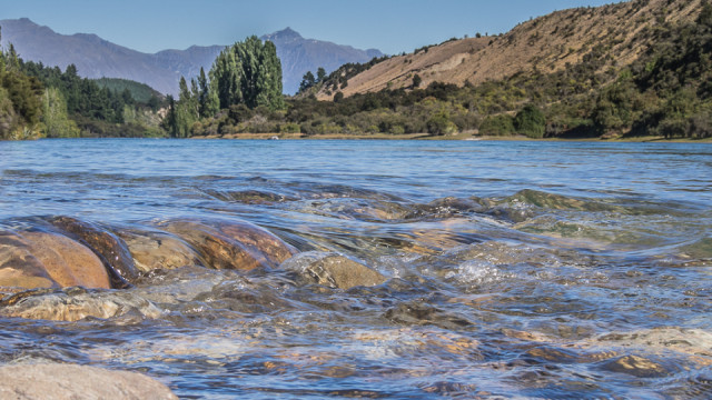
The mighty Clutha River
This morning I decided to walk along the banks of the clutha, here some history for you,the bank on the right is called Deans bank.
The Maori name for the Clutha from its source to the sea was Mata-au, meaning “surface current”, a reference no doubt to the river's swirling eddies. The early whalers and settlers of South Otago called the river and the district the Molyneux, and the name survived well into the gold mining era. It has often been stated that Cook gave the name Molyneux to the river, but this is incorrect for he never saw it.
What he did name was Molyneux Harbour which was probably in the vicinity of Waikawa. The correct name is the Clutha, first suggested in 1846 when the Scottish emigrants were preparing to settle in Otago.
The river has the largest catchment in New Zealand (8,480 sq. miles), and is reputed to have the greatest volume of water. It is the largest river in the South Island, being 150 miles from the lakes to the sea and 210 miles from its headwaters to the sea.
Its catchment area is most diverse. On the far west the country is mainly mountainous with peaks up to nearly 10,000 ft and a varying rainfall from 35–150 in. Large intermontane basins, with the intervening ranges rising between 3,000 and 6,000 ft, occupy the centre, along with extensive river flats and terraces between 900 and 500 ft altitude. Rainfall is as low as 12 in. per year at Alexandra, Central Otago. On the eastern and southern catchment area the country is generally lower, with hills to 3,000 ft and with a more rolling and mature landscape. Rainfall is higher, varying from 30–50 in. Approximately 2,800 sq. miles of catchment are held by the Lakes Wakatipu, Wanaka, and Hawea, which total 240 sq. miles of water surface.
151
views
- 11
- 1
- Olympus E-M5
- 1/125
- f/22.0
- 40mm
- 400
Comments New comments are not currently accepted on this journal.