
Weir and Island
River Eamont (Part 5)
I have finally got back to following the River Eamont. After the Wobbly Bridge, where I was last time, the river is hard to get to, as it runs through the Dalemain Estate and access is controlled to protect the fishing. Apparently one can ring the estate office and ask for permission to access the river and I was tempted to do this, just because. But I decided I really didn’t have the time or the inclination.
So, we moved further on along the river and walked down a narrow, but obviously well used, footpath that runs down to the river from the Ullswater road near to Stainton. This is a footpath I have driven past so many times, but had no idea where it went.
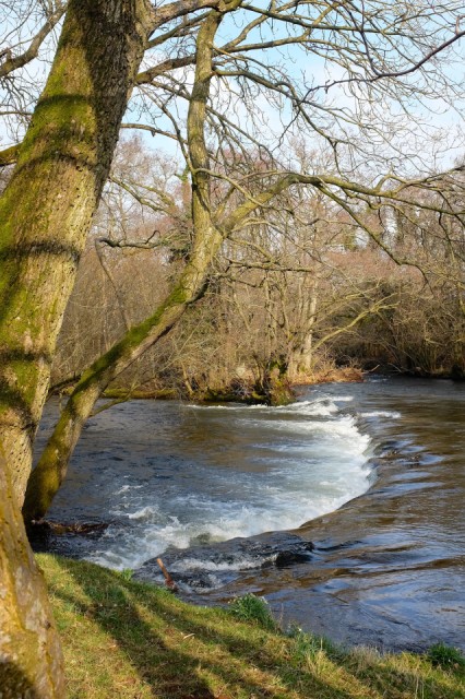
The river was running very fast and water levels were high. Walking to the right, along what is obviously a flood plain, you come to a weir, shown in the picture. I have no idea why the weir is here, unless there was a mill that has disappeared. You can see in the picture something else happening at this point. The river is dividing and forming an island. This is Stainton Island – an island of just over an acre that is common land belonging to the residents of Stainton township.
Follow the tags to find the first four blips in this series.
Worrying Blip times. The silence is unnerving. I’m clinging on and hoping, but saving journal pages and email addresses. My email is on my profile page. Please send me a note if you want to keep in touch and I haven’t already got your address. I’ll be here to the bitter end. But perhaps there won’t be an end at all.
Comments
Sign in or get an account to comment.


