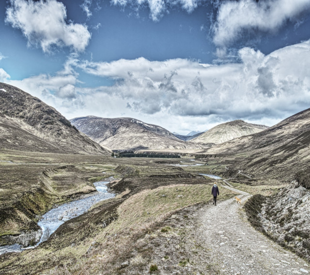
The Red River Valley
That's Glen Roy. Mrs SJR and I took Caley for a walk in the upper reaches of the glen. This is looking down the glen in the direction the water has drained for a good ten thousand years. The highest parallel road -ancient glacial lake shore line- which makes Glen Roy world famous if you are in to such things coincides with the Roy - Spey watershed ground level, which is just 5km east of here. This suggests that Glen Roy water spilled east in to the Spey system at that time. The present village of Roy Bridge would have been under a blanket of ice at least 250 metres thick in order to have dammed Glen Roy water to that level..
You think all that reshaping is long in the past but you cast an eye around this valley and you can see huge fluvial terraces scythed through by the river and steep slopes, still crumbling, with gouged hollows of land slides and resulting deposits lower down.
Comments
Sign in or get an account to comment.


