
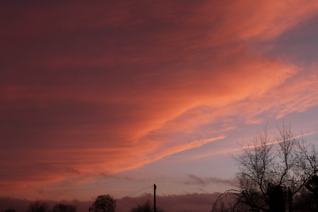
Another cloud shot
Shots like these are so ephemeral, if you're not in the right place at the right time you don't even know they existed. It had been raining all day, dull, dank and quite a contrast to the last few crisp clear, frosty days we've had.
Then, just as the sun was setting, it caught the underside of the departing rainclouds. The initiated amongst you will recognise this cloudscape as the trailing edge of a warm front that is now passing away to the east.as we enter the warm sector of an Atlantic depression.
Air in the warm sector is being lifted up a gentle gradient over a mass of colder air in front. It's called a warm front because that's exactly what it is, a gently sloping boundary between warm air in the warm sector and colder air ahead.
You often get similar views, sometimes more spectacular, as the trailing edge of a cold front passes as the gradient of this type of front is greater than that of a warm front and in effect shovels warm air in the warm sector upwards much like a snow plough works and so can be associated with sharp showers from a line of cumulo nimbus clouds.
Comments
Sign in or get an account to comment.


