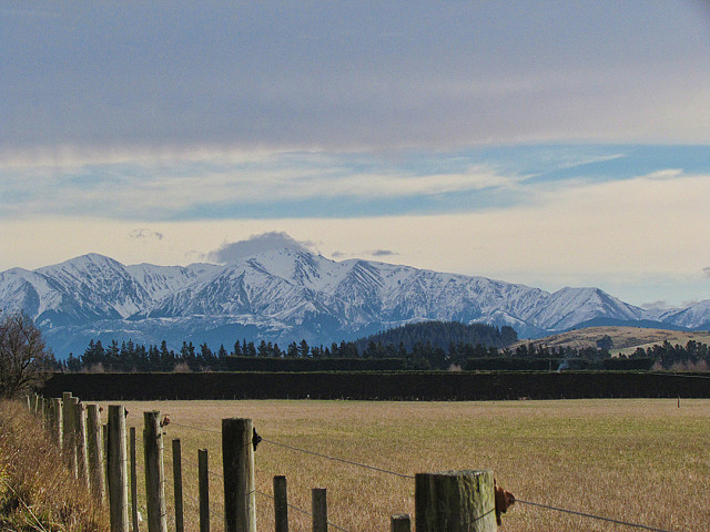
Puketeraki Range
Its not often I blip the rural area in which I live, I find it hard and challenging. There are no reflections to enjoy just many fence posts and powerlines to work around, sometimes I think I should have a footstool in the car so I can at least get above the fence line instead of having it spack bang in the middle - imagine what passing cars would think, a mad lady with camera standing on a footstool in the country - what next!
Anyway we are looking, hope I'm right, at a very small part of the bottom of the Puketeraki Range which stretches northwards, towards the right for quite some distance. The Oxford Forest, Ashely Forest, Ashley Gorge and Mount Thomas Forest are all part of the foothills of this range and home to Mount Richardson, Mount Grey and Mount Thomas and all quite accessible by foot.
Tawera is the Maori name for Oxford Forest, it means 'hot blow' referring to the Canterbury nor'west winds. There is a nor'west arch in the early stages of this image, the thick line of cloud just above the blue sky is the nor'west arch, bringing a change in weather, gusty warm winds followed by rain.
This part of the land is quite flat but becomes more rolling towards the foothills and further north. There are sheep and dairy farms along with some orchards, crops and grapes, forestry being on the foothills. Further behind the Puketeraki Range are the Southern Alps.
Perhaps I'll come out of my comfort zone of the coastline and try more rural shots - with footstool! No, just joking :)
Enjoy the rest of the week :)
Comments
Sign in or get an account to comment.


