
Strömfors Iron Mill
Today we took our day walk to Strömfors Iron Mill.
From their website:
"HISTORY OF STRÖMFORS IRON MILL
The begin of Strömfors iron mill area is strongly related to the golden age of the Swedish iron industry in 1600's when Finland was part of Sweden. The first tilt workshop was found in Petjärvi by baron Johan Creutz in 1698.
The current name of the area was given by Anders Nohrström and Jakob Forsell who bought the area in 1744 after the Peace of Turku. The new owners developed the trade of the area by establishing manufacture workshop, sawmill and mill.
Jakob Forsell was knighted later and his son captain of industry Henrik Johan af Forselles took the eminent role of the leader in Strömfors in 1781. Nine years later Henrik Johan's widow Virginia af Forselles started to supervise the area. She led the area very succesfully almost 60 years, till her dead in 1847. Most of the buildings seen in the area nowadays are from 'her Grace's' era.
Antti Ahlström bought the iron mill in 1886 and started to develop the sawmill trade. The iron mill workshops were shut down in 1950 after 250 years of succesful working and the sawmill was closed three years later. The electric and plastic accessories factory was established in 1947 by A. Ahlström Corporation.
Nowadays there are many operators, such as artisans, guide tour service, accommodation firm, restaurant and coffee bar working in the old, idyllic iron mill milieu."
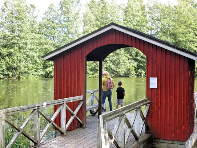
In the picture small boy fishing in Kymijoki / Kymi river. This is the westernmost of Kymi river. (from wikipedia:) "Kymi river begins at Lake Päijänne, flows through the provinces of Päijänne Tavastia, Uusimaa and Kymenlaakso and discharges into the Gulf of Finland. The river passes the towns of Heinola and Kouvola. The town of Kotka is located on the river delta. The length of the river is 204 kilometres (127 mi), but its drainage basin of 37,107 square kilometres (14,327 sq mi) extends to almost 600 kilometres (370 mi) inside the Tavastia, Central Finland, Savonia and Ostrobothnia. The furthest source of the river is Lake Pielavesi, its furthest point being some 570 kilometres (350 mi) from the sea measured by flow route.
Being one of the largest rivers in Southern Finland, the Kymi is a major source of hydroelectricity. The towns of Kotka, Kuusankoski, Myllykoski and Inkeroinen along the river are major centres of the pulp and paper industry. Formerly the river was extensively used for timber rafting.
The Kymijoki river has five mouths. It divides into two main branches near the Kultaankoski rapids in Kotka, about 15 kilometres (9 mi) inland of the Gulf of Finland. The eastern branch splits into the Korkeakoski and Koivukoski branches, the latter branch dividing again to form two mouths (Langinkoski and Huumanhaara). The Korkeakoski branch has only one river mouth.
The western branch divides into Ahvenkoski and Klåsarö branches, each with one mouth.
The westernmost Ahvenkoski branch of the river served as a border between Sweden and Russia from 1743 to 1809. The parts of Finland east of the river were later called Old Finland. Old Finland was incorporated in the Grand Duchy of Finland in 1812.
The Kymi is very swift: it takes three days for its waters to run from lake Pyhäjärvi to sea. Its mean depth is 9 metres (30 ft), and the deepest place is 29 metres (95 ft)."
More pictures in Insta.
Comments
Sign in or get an account to comment.


