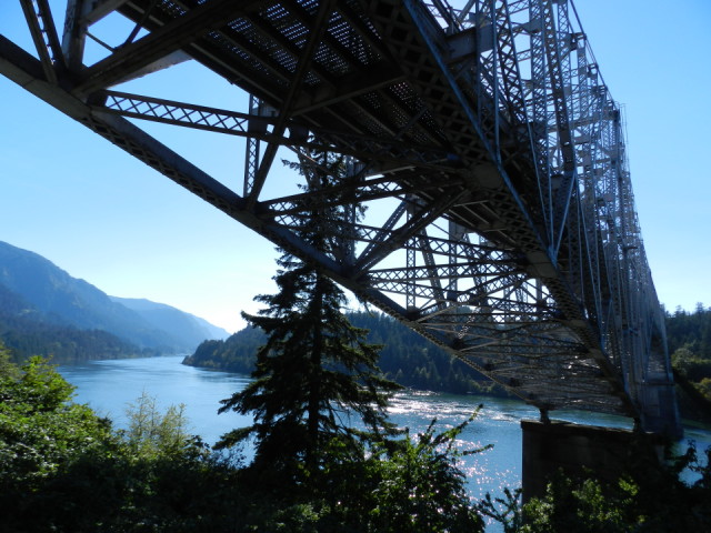
Bridge of the Gods
Stopped in Cascade Locks for a break on the way home and took this photo of the Columbia River and the Bridge of the Gods. The Pacific Crest Trail crosses the Columbia River on this bridge. I met some PCT hikers at the Dairy Queen that was made famous by both Cheryl Strayed, author of the memoir, Wild, and Reese Witherspoon for her role in movie Wild.
See below for the geology that created this land bridge and the legend of how this bridge got its name.
In the heart of the Columbia River Gorge, The Bridge of the Gods was a land mass, so named by the Native American tribes, that covered a part of the Columbia River in about 1450 AD. This “bridge” was a blockage caused by the Bonneville Landslide, which headed on the southern escarpment of the 3,417-foot-high Table Mountain on the Washington side of the river and cascaded downward, filling the Columbia River valley with more than five square miles of debris up to 400 feet thick.
Today a 1,858-foot-long steel-truss bridge of the same name spans the Columbia River at Cascade Locks, about forty miles east of Portland. The Bridge of the Gods, first built in 1926.
The Bonneville Landslide almost certainly gave rise to the Klickitat legend of the Bridge of the Gods. Oral tradition about the bridge tells how people “could cross the river without getting their feet wet.” Reportedly, “the river was dammed up at this place, which caused the waters to rise to a great height far above and that after cutting a passage through the impeding mass down to its present bed, these rapids first made their appearance.”
The rapids became known as Cascade Rapid, sometimes called the Cascades of the Columbia, a set of rocky rapids descending more than 22 feet over about 600 yards and then another 30 feet over the next 8 miles. The rapids are the remnant debris of the landslide dam. After blockage by the Bonneville Landslide, the Columbia River formed a great lake behind the debris dam, perhaps 300 feet deep and extending as far as Wallula Gap, about 170 miles upstream.
Sometime after overtopping, the river cut through around the southern edge of the landslide mass. The downcutting was not yet complete, however, and large rocky debris too big to be carried away by the river remained, creating the set of foaming rapids, first mapped by Meriwether Lewis and William Clark as “The Great Shoot.”
(Authored by Jim O'Conner and posted on the website, Oregon Encyclopedia: https://oregonencyclopedia.org/articles/bridge_of_the_gods/#.V7aBe5OAOko)
Comments
Sign in or get an account to comment.


