
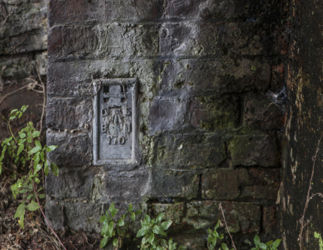
Wallbridge OS Datum point
I spent a long while walking around town taking reference pictures for the presentation that Camilla will give next Tuesday about the Local Listing project. several volunteers having been recording what are regarded as interesting features of the built environment around the town centre as promised for the Neighbourhood Plan.
I had been told about this very small addition to the underside of Wallbridge, which formerly took the A46 road across the Stroudwater Canal in about 1800. The plaque marks the 1912 Ordnance Survey Datum Point.
Comments
Sign in or get an account to comment.


