
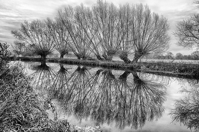
OneRiver: Mountsorrel Meadows
Time and time again
The Danelaw marched its army from Leicester up to Derby
And back.
They built the Derby road
Through thick forest, along the river.
Once all was peaceful here
The bustle of the Great North Road far to the east
To the west motorway madness carves chunks from Charnwood.
Remaining trees defensive wall of willow catches the din of Derby traffic
And holds the peace of the east.
Mountsorrel Meadows | OneRiver.
Sony ILCE-6000
E PZ 16-50mm F3.5-5.6 OSS
f8 18mm ISO 100
4 stop HDR.
OneRiver projects normally involve following and photographing a river from its source to the sea. I have something different in mind. Leicestershire has one outstanding geographical feature, the river that bisects it into two distinct halves - sticky but fertile Jurassic Lias to the east, Triassic marls, the Precambrian island of Charnwood Forest and coalfields to the west. And the River Soar runs neatly along a deep bed of boulder clay and modern alluvium in the fold between the two, as it has done since the glaciers retreated.
What is this OneRiver Project?
A portfolio of 12 photographs documenting the course of the River Soar through the county of Leicestershire.
How long will it take?
Until I have 12 images of acceptable quality. This is a geographical project not a chronological one.
What's the poetry about?
That's the jeopardy. If it works, the fragments will build into an impression of the river alongside the pictures. I have no idea if the final version will hang together.
369
views
- 26
- 8
Comments
Sign in or get an account to comment.


