The cave and the missing cliff
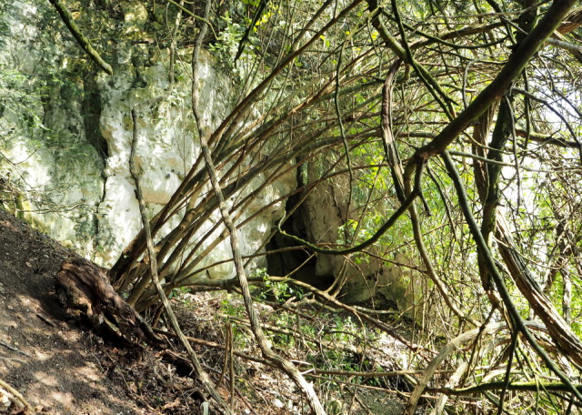
There was an orienteering event today in some rather brambly woods on the top of the North Downs. I went along with Mr P who wanted to run but I decided instead to use my O map to look for a geocache what is described as terrain 4.5 (5 bring the most difficult) and has lots of "favourite" votes . I did find the cache in the end, at the bottom of the cliff you can see as an extra after I had hunted round the cave above. It was easily big enough for me to walk inside. Neither feature is on my O map. Getting to the cave involved some very hairy scrambling down steep slopes on my bottom hanging onto tree branches and roots to avoid disappearing down the face of the North Downs. Realised I was too far west so retraced my steps to scramble up , round and down the other side of the cliff to find the cache At one point I thought I was stuck and wondered if the search party would come with a rope. I also thought perhaps I should come back with a young agile person to help me but when your GPS gadget says you are only 20m from the cache, a kind of obsession to find the small plastic box takes over. I showed my photo of the cliff to the orienteering event planner when I got back. He was quite horrified and will be going to look for the cache so that he can mark the cliff on the map. Sometimes we orienteer in these woods at night and we would not want someone on a compass bearing through the woods, to go flying off the top of the cliff.
Comments
Sign in or get an account to comment.


