
A Touch of Blackadder - Damn those French Inches!
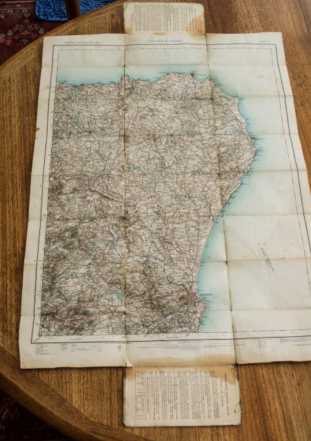
This 2" to the mile map was produced in 1909 from the 1" map of 1906-8. It is part of the "Ordnance Survey of Scotland." Brave chaps from Southampton, where the OS is based, ventured North and did their thing, there are no records to indicate how many went and then how many returned.
In 1909 the magnetic variation at Aberdeen was 18*29' West. (Take a protractor measurement off the map and add 18* to get the compass heading you require) The present day Magnetic Variation for Aberdeen is 4.1* so that's quite a shift in the position of the magnetic pole.
Boring bit over. The map is made of heavy linen, the cover is cardboard, I was initially puzzled by the stains on the corners and the edges of the cover. That was until I took a magnifying glass to the writing and stamp on the front.
There is a just readable rubber stamp, part of which reads "General Staff," written in pencil underneath in a beautiful hand are the initials RFC. From which Sherlock deduces this was once a mainstay of some poor open cockpit warrior's kit, possibly even Captain Flasheart!
PS The oily stains to the teak table were caused by some lunatic allowing all the inks from a printer to empty onto the surface. It was a big boy wot dun it and ran away.
Comments
Sign in or get an account to comment.


