Almost
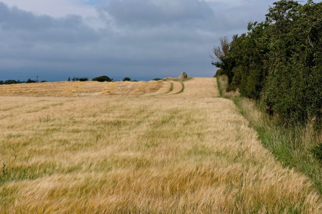
If you look closely at this photo, you should be able to see a standing stone, at the top of the hill, in the middle of a field of barley - Lochmaben Stone, near Gretna.
When we were in Keswick in March we went to listen to Graham Robb talking about the Debatable Land, a piece of land between Scotland and England that was once an independent territory, was fought over many times and was notorious for being a centre for the exploits of the Border Reivers.
We were fascinated, as it is an area close to where we live, but we knew virtually nothing about it. We bought his book and have both read it. The amount of research Robb did is impressive and he tells a very interesting story.
We thought we would maybe explore a bit of the Land, as there are obviously places to be seen that he mentions in the book. And we thought we would start at the Lochmaben Stone, as it stands at a corner of the Debatable Land, at a place where Scotland and England meet and where the River Sark reaches the Solway. The Stone, a huge block of glacial granite, was once part of an ancient stone circle and since those times has been the centre of much history. It was a meeting place for ambassadors and wardens of the Debatable Land, a place where prisoners were exchanged, disputes settled, truces discussed. It has been the site of battles and is linked in legends to King Arthur.
A shame then that you cannot actually get to it. Ironically at the parking place, used a lot by local walkers for walks along the shoreline and incidentally at a place called Port Stormont, known for smuggling in years gone by, there is an information board, telling in some detail all about the Stone. But there is no indication where it is or how to get to it. Not to be put off we followed the map and walked alongside the shore of the estuary, trying to find the field. Robb also had difficulty finding it and describes accurately the terrain – “an area of oily runnels and deep chasms strewn with agricultural rubbish.” And it must be extremely boggy most of the time, it was only today after so little rain that it was actually passable . . . just. Then you come across barbed wire – lots of it, and the impossible task of getting to the stone, even though there was an obvious path at the edge of the field. So a photograph from a distance had to suffice.
Extra
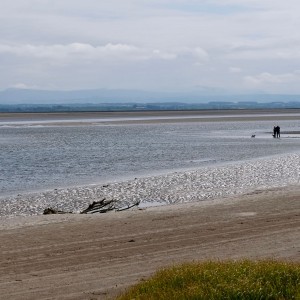
Looking in the opposite direction across the Solway to the Cumbrian hills. The River Sark acts in this area as the border between Scotland and England and as the river channel is close to the shore, it is probable that the figures you can see are actually on the border – I thought that was interesting.
Comments
Sign in or get an account to comment.


