South West Coast Path - Swanage
One of the finest sections on the South West Coast Path is the Durlston Country Park. Walking over rocks here is a little rough, and appropriate footware is essential.
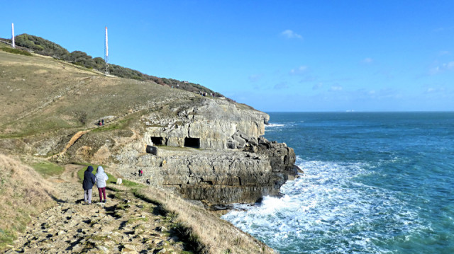
Rock falls in 1976 made it no longer safe to visit the abandoned stone quarry at Tilly Whim. This photo gives an idea of the working conditions of the miners.
The two white pylons (at top left) are the eastern parts of a measured mile marker. Another two markers are erected on the coast 2,000 yards (one nautical mile) to the west. The purpose is to measure the exact speed at which a ship is sailing. The speed in knots is measured by the time taken for the ship to cross the first to the second paired markers.
The significance of paired markers is that when exactly in line they provide a "virtual line" to provide starting and finishing positions.
On the horizon you can just see the chalk cliffs of the Isle of Wight. (Seeing this photo in LARGE format will give much more detail)
Comments
Sign in or get an account to comment.


