Maol Ruadh
Desk day today. Before it started I joined M with the dogs and went over the field and up Maol Ruadh. The ground was icy and frozen hard. To the dogs delight we went further than normal, over the fence on the sky line, and across some normally very soggy going to the true summit of the wee hill. Don't laugh when I say the spot height on the OS map says a giddy 258m. The lowest parallel road and therefore last ice age reservoir level contours round the adjacent slopes at 261m. So if nothing else has changed topographicaly mean time - in the last 10,000 years - Maol Ruadh's small plateau summit would not even have breached the surface of the icy lagoon and would only have become exposed on that final dramatic drainage of Glen Roy.
In addition to the low temerature there was a breeze today and to our flimsy human make up it felt bitterly cold. M's gloved hands lacked feeling by the end. I know it felt cold because M was starting to wish she had taken a hat, a garment she has a real aversion to.
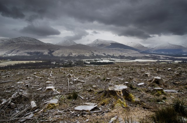
On Google Earth satellite view Roy Bridge is very easy to spot from a long way out because of two converging patches of commercial woodland just to the north of the village. There is a big one to the left (west) and small one to the right. The north end of the small one terminates just before the Maol Ruadh summit crest. The imagery is slightly out of date as both patches are under going (or gone) harvest operations and this is the current view south over the wee one back down to the village.
Despite the cold I can't see any glaciers developing in Glen Spean.
Comments
Sign in or get an account to comment.


