
Bridge 143 - Old Site of Kennison's Bridge
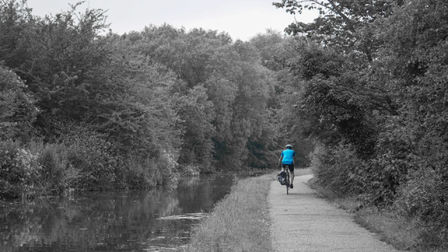
This is the site of bridge 143 on the Shropshire Union Canal. You can just make out a bulge on the left hand bank which the cyclist is about to pass.
It is labelled as Kennison's Bridge on a 1912 map and it still existed on my OS map of 1952. In both cases the bridge was in the middle of the countryside and to be fair that looks to be the case from my photograph. However, just behind the trees on the left hand side is the M53 and on the right hand side is a vast area of waste land where a factory has been cleared.
Looking at the 1952 map this appears to be close to the site of a building called the Grange. There is also a moat which, according to the older maps was the site of Grange Cow Worth an old monastic grange. All signs of their existence have long gone and have been covered by housing and the motorway.
It was built in 1795 by Thomas Telford and it appears to carry a footpath across the canal. On a 1938 map it looks like the footpath goes from Little Stanney via the Grange, across the canal then under the railway to the industrial sites at Stanlow by the Manchester Ship Canal I haven't been able to find any old photographs but there must be one somewhere as it can only have been removed in the 1950s or 1960s.
I'm not a big fan of gimmicks in photos but this selective colour seemed to work and it makes a more interesting photo than the original version. In the end I quite like it but I think it will be a one off :)
Comments
Sign in or get an account to comment.


