
The Heights
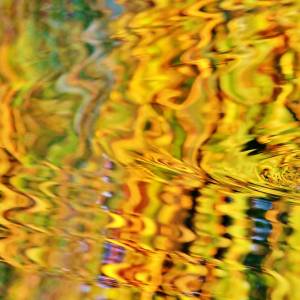
I took Ollie dog for a walk in the area suggested by springer dog man at Lodge Farm the other day. We turned left at the mini-roundabout in Bumbles Green and ended up in a steep bridleway. We parked the car once we had run out of road in a wooded area that I had walked to from Harold's Park Farm in the past. This area is one of the highest in Essex. Unusual for me to take a landscape shot. I had to press my 35mm macro lens into service. I've used the in-camera HDR facility. Not my thing but there are plenty on here who employ extreme processing, so what the hell? :)
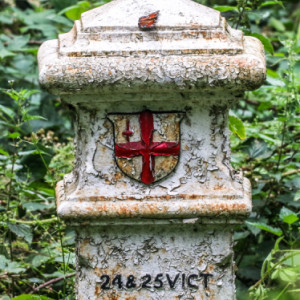
Near the sign stating that the woodland is part of Epping Forest I noticed a peacock butterfly on a white column in the brambles. (Extras) How interesting that this is one of the cast-iron markers erected in the 1860s marking the boundary of the area where coal taxes were payable to the Corporation of London.
"Coal tax posts mark the point at which the historic duty on coal being brought into the City of London became payable to the Corporation. There are around 210 markers – with the cast iron post as seen here being the most common type – placed in an irregular ring between 12 and 18 miles form the centre of the City, even on the most obscure byways (as here!). When first levied in 1666, the duties were meant to support the rebuilding – particularly of St Paul’s Cathedral – after the Great Fire. They were subsequently used for more general infrastructure projects until they were abolished with the formation of the London County Council in 1889."
Comments
Sign in or get an account to comment.


