
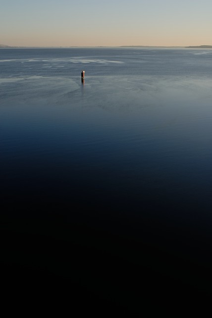
The Inner (Moray) Firth, from the Kessock Bridge this morning. Having to cycle on this side of the bridge for a change, whilst the works on the bridge are being carried out. A much more open view.
A lot of people will mistakenly call it the Beauly Firth, but that's on the other (West) side of the bridge, and ends where it is joined by the River Ness (...as far as I'm aware). On old maps and charts, the Inner Firth is sometimes referred to as the Inverness Firth. Once you pass Chanonry point, you're into the Outer Firth, or just the Moray Firth. That extends for a very long way...
The red thing is a channel marker for shipping. Both the Beauly and the Inner Moray Firths, are extremely shallow in most of their area. Sea-going types ignore the channel markers at their peril. There's usually at least one member of the sailing fraternity that ends up running aground each year. It could take a fortnight for a high enough tide to lift any such boats. It's much less of an issue if your craft only requires about four inches of draft... though there's a good (alleged) story about a couple of local kayakers to regale sometime.
Another cold, and beautifully clear day. Minus five when I set off this morning.
Comments New comments are not currently accepted on this journal.