
A Working Drone
Working but unpaid (I'd need a licence to do commercial work with a drone).
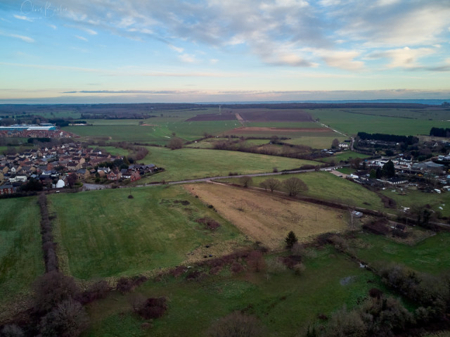
I was photographing the gaps between the village and the outlying hamlets for the Neighbourhood Plan; one of the defences against careless proliferation of housing is the desire by the inhabitants to protect the identity of the settlements, to some degree at least. This the southern edge of our village, with one of the hamlets on the right, and the gap is what we're trying to protect.
You can see the course of the old railway line coming off the road in the centre to the bottom right. If you look carefully you can see the course as it goes across the field, past the housing estate and up towards the blue warehouses – where it runs past the houses was the site of the railway station. It's easy to see in the Google Maps depiction.
There are plans to revive the east-west railway lines, but it will be a new line further north of Gamlingay, calling at Cambourne (I think) and a new station in Cambridge. It will not be a place to live a calm and tranquil life and is one of the reasons that we're moving southwest.
Comments
Sign in or get an account to comment.


