
Motorway over the Moors
It was almost dark again when I realised that I was without a blipfoto, so I jumped in the car and found myself three and a half miles up the road from home on top of the Pennine moors at Scammonden.
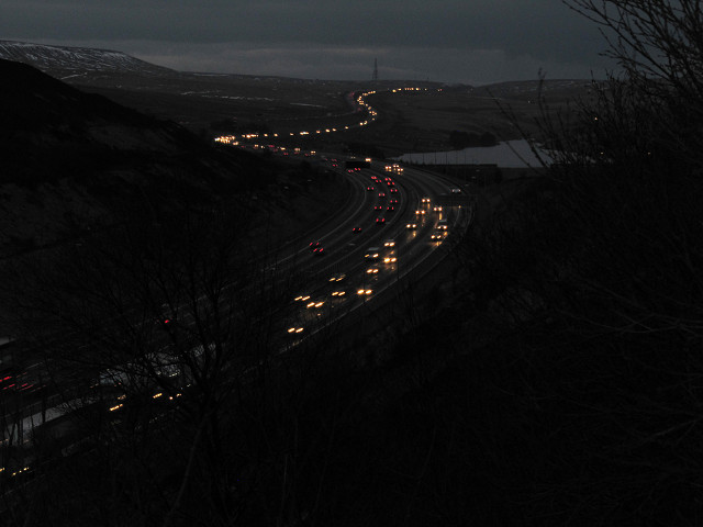
This is the view looking west from Scammonden Bridge. On the horizon is Windy Hill 1100 ft which forms the boundary between Lancashire and Yorkshire. The Pennine Way crosses the motorway at this point.
If you look carefully you can just make out that the carriageways dramatically cleave in two. Standing slap-bang in the middle is Stott Hall Farm - an agricultural island marooned between the thundering traffic on the eastbound and westbound carriageways. Poet Simon Armitage, from nearby Huddersfield, memorably likened it to the M62 "unzipping it's flies".
Legend has it that a hardy sheep farmer called Ken Wild refused to budge as the bulldozers inched ever closer to his doorstep and that the Department of Transport was forced to spend millions to completely re-route the road.
The 7 miles of motorway viewed from the bridge presented the motorway builders with their greatest challenges - five major rock cuttings, the removal of impassable peat bogs, a major dam, as well as some of the worst weather in the country.
When looking east towards Huddersfield you can see Scammonden Dam on the right. The dam was the biggest single job and its rate of progress determined the time of completion for the whole scheme.
Scammonden Bridge
It was cold up there
Comments
Sign in or get an account to comment.


