
Isle of Dogs
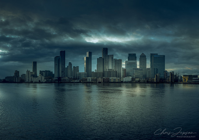
Not a view I have seen before - taken looking west from the 'back' of the O2.
The Isle of Dogs is a large peninsula bounded on three sides by a large meander in the River Thames in East London, England, which includes the Cubitt Town, Millwall and Canary Wharf districts, Canary Wharf being the secondary central business district of London, one of the main financial centres of the United Kingdom and the world, and containing many high-rise buildings including the third-tallest in the UK, One Canada Square.
The area was originally sparsely populated marshland before its drainage and planting in the 13th century. A catastrophic flood occurred in 1488, resulting in the area returning to its previous marshy condition. This was not reversed until Dutch engineers re-drained it in the 17th century.
The first known written mention of the Isle of Dogs is in the ‘Letters & Papers of Henry VIII’. In Volume 3: 1519–1523. 2 October 1520. No. 1009 – ‘Shipping’, there is a list of purchases, which includes:
A hose for the Mary George, in dock at the Isle of Dogs, 10d
The exact origin of the name is not entirely known, maybe it came from being the site Edward II and Henry VIII kept their hinting dogs, maybe it is a corruption of Isle of Ducks due to it's marshes or maybe from the presence of the Dutch engineers naming it Isle of Dykes which then got corrupted over the years.
Extra shows the Isle of Dogs as depicted in John Rocque's Map of London, 1747, formally titled A plan of the cities of London and Westminster, and borough of Southwark, showing the area before development.
Comments
Sign in or get an account to comment.


