Old Scotch Road / Galwaithegate
In centuries past, drovers would bring their cattle down from Galloway, taking them all the way to the south of England. Part of the route was called 'Galwaithegate', meaning - according to Wikipedia, at least - 'the road to Galloway'.
The route came down through Orton and Tebay, on to Lambrigg, and then straight down to Old Town, which was one of the many places that drovers might rest overnight, at what is now Durham Ox House.
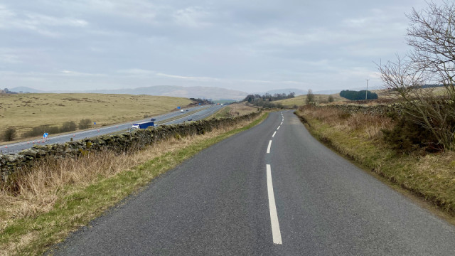
The Galwaithegate carried on south from there, of course, but that stretch between Lambrigg and Old Town is called the Old Scotch Road*. The Minx dropped me at the top of that today and I ran all the way down it and then continued southwards to Kirkby Lonsdale. (I would guess that the market there is one of the places the cattle would have changed hands, although it seems that there was a cattle market in Old Town every October.)
Just over thirty years ago, I would leave work in Weybridge at a quarter to four on a Friday afternoon, drive 'round the M25, and then up the M1 and M6, exiting at junction 37 around eight o'clock. From there I would take two miles of the Old Scotch Road to Lambrigg and turn west to Grayrigg where my girlfriend lived.
Before I took that turning, I would check all my doors were locked. City boy that I was back then, I was terrified of the dark!
***
Reading 'Jews Don't Count' by David Baddiel
*From there it looks on the map as if it extends up to Lowgill where there's another branch also called Old Scotch Road. Irritatingly, I can't find a canonical version. However, the section from Lambrigg to Old Town is at least the final section, if not the whole shebang.
Comments
Sign in or get an account to comment.


