Pont wos 'ere
I've been pondering (ho-ho) for some time why, on the Blaeu Atlas of 1654 that was surveyed by Timothy Pont, a place Bin Vevii appeared on the western end of Benbecula. See the map for yourself here.
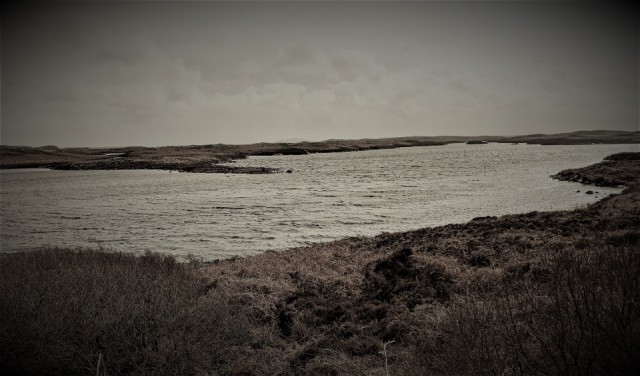
Today walking behind Rueval on Benbecula it became clear. If you look carefully, a bump is discernible at the centre of the skyline and it is the only hill visible. It is in fact the island Wiay and so I suspect Mr Pont back in the late 16th century climbed Rueval to get as close as he could to getting satellite imagery, asked the locals what the hill was called and they replied 'Wiay' but he thought 'it is hill - I'd better add bin', his equivalent of the modern Beinn.
/v/ and /w/ were pretty interchangeable then and so Vevii is not far from Wiay. Much further away forme is the modern Gaelic equivalent, Fuidheigh.
161
views
- 3
- 0
- Google Pixel 3a
- 1/10000
- f/1.8
- 4mm
- 70
Comments
Sign in or get an account to comment.


