
The height of excitement - still!
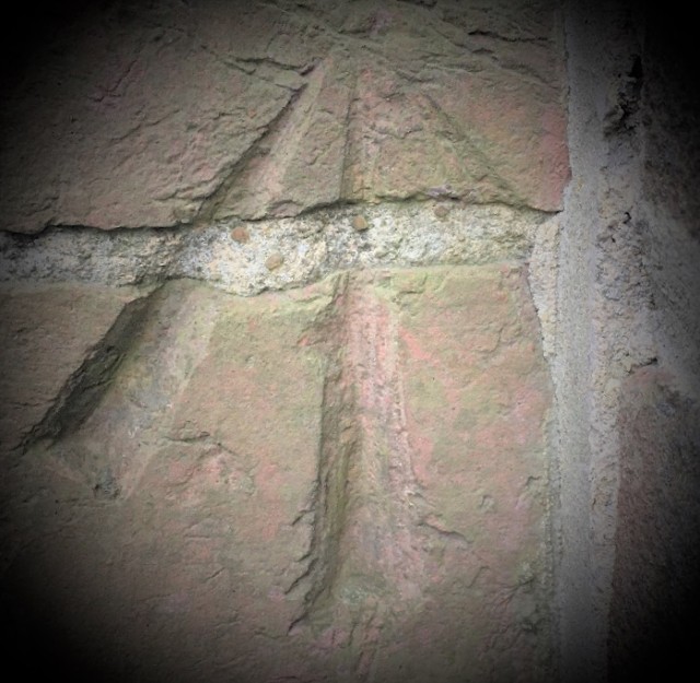
Our house was built in 1874 and when we bought it 18 years ago, we were thrilled to be given an envelope containing its entire history, including details of the builder, every previous owner, old mortgage papers and even aerial photographs. What we didn't realise until a few years later was that it also had an Ordnance Survey benchmark on it. They were not allowed to be covered up but whoever added on our porch later went as close as they could.
According to current data, our house sits at an elevation of 124.269m (give or take a hundredth of a millimetre!) but I'm guessing it was probably at exactly 125m when the benchmark was made. The earliest I have found it mentioned in OS records is in 1972, which would coincide with the increased efforts in mapping that began in the late 1960s, but it certainly looks much older.
Although the function of these benchmarks has long since been replaced by satellite GPS systems, as a geography teacher it’s still amazing to know that our little house once played such an important role in Ordnance Survey operations.
158
views
- 5
- 0
Comments
Sign in or get an account to comment.


