
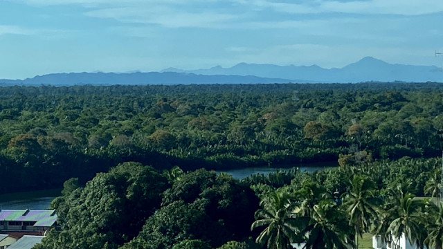
Mount Mulu from Tutong
The following morning, the skies had cleared after the horrendous thunderstorm the night before. And before the clouds bubbles up in the afternoon the visibility was awesome, so much so that the mountain in the middle right of the photo is Gunung Mulu, some 90km east in the distance.
Mount Mulu (Malay: Gunung Mulu) is a sandstone and shale mountain. At 2376m (7795ft) it is the second highest mountain in the state of Sarawak, after Mount Murud.
In the 19th century, Spenser St. John and Charles Hose, attempted to conquer Mount Mulu. However, their attempts failed. It was only in the 1920s, when a Berawan rhino hunter named Tama Nilong discovered the south-west ridge near the mountain which eventually led to the summit. In 1932, Tama Nilong led Lord Shackleton and an Oxford University Expedition to the summit of Mount Mulu.
Comments
Sign in or get an account to comment.


