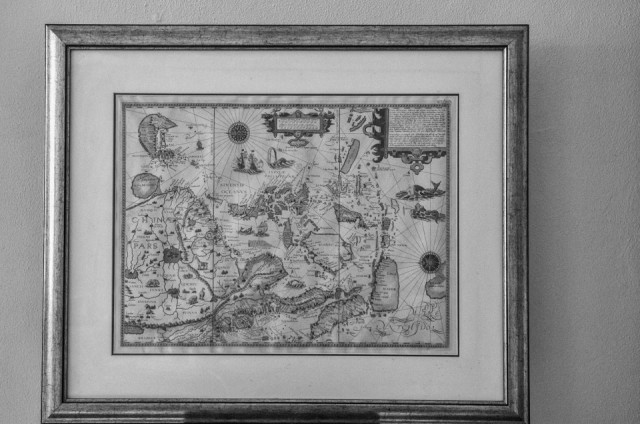
Map of South East Asia anno 1596
When mankind started to draw be it in script or in images that was the way to communicate and transfer knowledge and the sure way to progress. Maps , especially geographical maps, helped people to travel and explore. It's hard to imagine in our times how insecure it must have been to sail into uncharted territory not knowing if you'd fall off the edge of the world or not. I so love old maps and the stories they tell about exploration (even though I do also know and acknowledge how these explorations led to appropriations and exploitations).
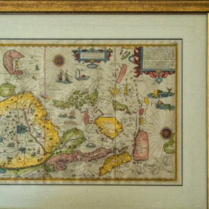
The map you see in my Blip is a replica of the map of South East Asia as drawn by Jan Huygen van Linschoten in his Itinerario book printed in 1596. He was an accountant, merchant and explorer who worked for some time as a clerk for the Portuguese clergy in Goa and copied their secret maps of South East Asia. You could say he was one of the first international spies really ! I love the decorations with sea monsters ! See the colours in the extra.
For today's Mono Monday theme of inventions of any time with much thanks to laurie54 for such great themes this month, very sorry to hear she has a bad concussion after a fall, feel better very soon !
Thanks very much for the kind comments and stars for yesterday's shadows Blip with the Abstract Thursday results.
Comments
Sign in or get an account to comment.


