
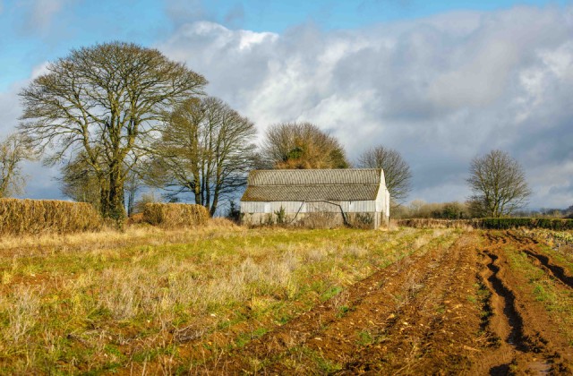
The Dutch barn at Stancombe, beside the Calfway
Back at Stancombe Beech Farm I looked for the hare that Keith reported seeing last week close to the cabbages in this field by their Dutch barn. I slowly walked around the field and looked along the rows of carrots, cabbages, Brussel Sprouts, and red cabbages but there weren’t signs of any animals. I did notice large tooth marks on the top of some of the carrots that are in these ridges of soil which showed there were likely to be deer, rabbits and hares enjoying the crops.
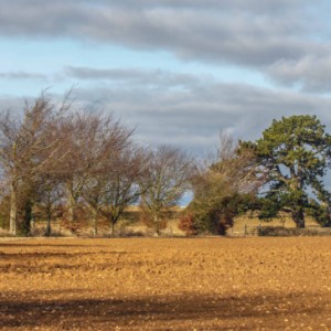
This view shows the red clay colouring the soil, but not much of the brash of Cotswold limestone that intermingles with the clay. I always look down for interesting stones or other finds as there was a Roman settlement in what is now the nearby Bisley village. When he is ploughing or walking their fields Ashley, who is Keith’s elder brother, often finds arrow heads and stone cutting tools from Neolithic times, as well as a few Roman coins. I enjoyed a public talk he once gave about his finds in the village hall some years ago.
The hedge to the right of the Dutch barn marks the meandering line of the ancient Calfway, which was originally an important trackway linking the north of the Cotswold hills with its southern parts. It would have been used as a drove road to allow animals, including cows, sheep and even ducks, to be moved from as far away as Wales to the larger towns of the time. It may well also have been used a Saltway bringing the vital salt for food storage from the northern salt mines at places like Droitwich.
This particular spot was an important point on the ancient early ‘road’ systems because another old track, more recently renamed for modern tourism purposes as the Wysis Way, joined the Calfway about fifty yards from where I was standing. You can just see it in the ‘Extra’ photo on the edge of the field in the middle foreground. It runs beside the field with the small trees following its line to a gateway. It then runs westwards towards the tall plantation of beech trees on the far right and then off down across the Slad valley to Painswick and then Gloucester. It linked these places with the ancient Roman city of Corinium, which is currently called Cirencester. Both of these trackways are mentioned as being old in written texts dating from the 13th century. They would have always been important both as local paths, as well as parts of the wider and extensive long-distance track systems that covered the country for thousands of years.
Comments
Sign in or get an account to comment.


